
The Mojave Groundwater Bank’s Safe Yield Supports Water Supply
Monitoring and adaptive management guide how the Mojave Groundwater Bank conserves groundwater before evaporation, providing new supply for California and the Southwest.
Cadiz estimates that the aquifer system supporting the Mojave Groundwater Bank holds more than 30 million acre-feet of groundwater. The project would conserve fresh water before it reaches saline dry lakes and evaporates. Its county-approved management plan combines monitoring and adaptive management to support an average annual supply of 50,000 acre-feet while protecting groundwater and desert resources.
Summary
- Cadiz estimates more than 30 million acre-feet of groundwater in the aquifer system supporting the Mojave Groundwater Bank, replenished by rain and snow.
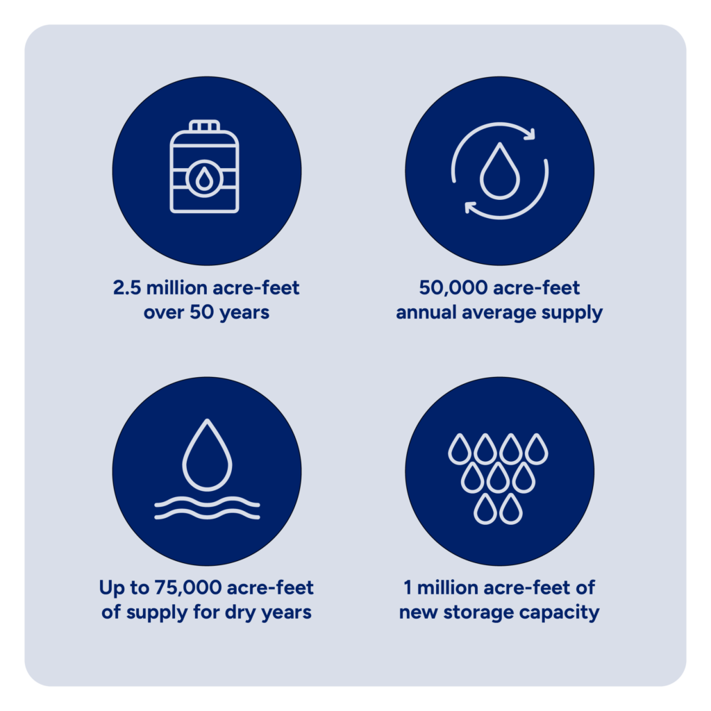
- The Mojave Groundwater Bank’s safe-yield plan provides a supply averaging 50,000 acre-feet annually over 50 years, with a 75,000-acre-foot single-year maximum and a 2.5-million-acre-foot cumulative total.
- The Mojave Groundwater Bank’s management plan combines monitoring with enforceable safeguards designed to protect groundwater, springs, water quality, and desert resources.
- San Bernardino County oversees the Mojave Groundwater Bank’s groundwater safeguards, informed by technical review and monitoring of groundwater levels, water quality, springs, subsidence, and air quality.
- Cadiz Ranch’s agricultural monitoring history extends back to the 1990s. Its 2019–2023 report documents seasonal groundwater recovery and no observed subsidence relative to the 1997 baseline.
Safe Yield Guides the Project’s Annual Water Supply
The Mojave Groundwater Bank sits at the base of a watershed replenished by rain and snow in surrounding mountains that rise above 7,500 feet. Cadiz estimates that the aquifer system holds more than 30 million acre-feet of groundwater. Water moves slowly underground toward the valley floor and the dry lakes, where it becomes saline and evaporates.
The project’s safe-yield plan provides for a water supply averaging 50,000 acre-feet annually over 50 years, totaling 2.5 million acre-feet. Supply may reach 75,000 acre-feet in a single year, with lower volumes in other years to maintain the long-term average.
The management plan pairs these supply parameters with monitoring and corrective measures to support supply sustainability and protect groundwater and desert resources. Monitoring allows the project’s operators and County overseers to assess conditions as operations proceed and adjust operations when necessary.
The conservation plan draws on aquifer recharge and storage. Managing groundwater levels would recover stored fresh water beyond the wellfield before it reaches the dry lakes, becomes saline, and evaporates. Recovering that stored water is why the plan provides for a supply greater than annual recharge, as explained in the Final EIR’s conservation analysis.
California Courts Upheld the Project’s Environmental Approvals
The California Court of Appeal upheld the project’s challenged environmental approvals in 2016. Its 2016 appellate opinion upheld the environmental review of the planned supply: 2.5 million acre-feet over 50 years, averaging 50,000 acre-feet annually, with up to 75,000 acre-feet in a single year.
The court explained that the project’s conservation purpose includes saving fresh groundwater before it drains to the dry lakes and becomes nonpotable. This supports recovery of stored freshwater alongside water that would otherwise evaporate.
Water supplied under project contracts, including County allocations, is covered by the project’s safe-yield plan. The County MOU gives local public water systems first priority for annual supply not already committed under binding agreements when the 2023 amendment took effect. Before entering a new agreement for use outside the County, Cadiz must give the County an opportunity to designate a local public water system to obtain that supply on substantially similar terms.
Monitoring and Adaptive Management Protect Desert Resources
The county-approved groundwater management plan is designed to prevent adverse impacts while supporting the planned water supply. It combines monitoring with protective and corrective measures, allowing operations to respond to observed conditions.
San Bernardino County retains oversight, and Santa Margarita Water District has responsibilities under the plan. The required Technical Review Panel reviews technical information and recommends action to the County.
Monitoring covers groundwater levels, water quality, springs, subsidence, and air quality. The plan requires protective action when monitoring identifies a need, with defined safeguards and corrective measures for the affected resources.
The groundwater floor is an averaged management level within a two-mile radius of the wellfield, initially 80 feet below baseline. The plan permits short-term incursions of three consecutive years or less only under specified conditions. These include maintaining the ten-year average at or above the floor and meeting the plan’s requirements to avoid undesirable results.
After 15 years of operation, the plan allows an application to lower the floor, subject to technical review and County findings.
Agricultural Monitoring Informs Groundwater Management
Cadiz Ranch’s agricultural monitoring history extends back to the 1990s. A published 2019–2023 monitoring report describes seasonal pumping and recovery cycles. Irrigation-well levels were slightly below baseline following increased pumping, while monitoring wells outside the wellfield showed no significant long-term fluctuations.
The report found no significant groundwater-quality changes overall and no evidence of subsidence relative to the 1997 baseline.
Planned Water Supply Has Groundwater Safeguards Built In
The Mojave Groundwater Bank’s safe-yield plan provides for an average annual supply of 50,000 acre-feet over 50 years, with groundwater management overseen by San Bernardino County. Groundwater monitoring informs adaptive management under the plan.
Decades of agricultural monitoring at Cadiz Ranch, technical review, and built-in safeguards guide how the project conserves water that would otherwise reach saline dry lakes and evaporate.
Frequently Asked Questions
How Does the 75,000-Acre-Foot Annual Maximum Fit the Safe Yield?
Withdrawals may reach 75,000 acre-feet in one year, with lower withdrawals in other years to maintain the long-term annual average of 50,000 acre-feet. The Mojave Groundwater Bank’s safe-yield plan provides for a total groundwater supply of 2.5 million acre-feet over 50 years.
How Many People Could the Mojave Groundwater Bank’s Annual Supply Serve?
The planned average annual supply of 50,000 acre-feet is enough to meet the annual water needs of roughly 400,000 people. Participating water agencies would use project water alongside other sources in their supply portfolios.
How Does the County MOU Prioritize Local Water Providers?
The County MOU, updated in 2023, gives County public water systems first priority for annual project yield not already under a binding written agreement when the update took effect. It also retains a 20-percent annual reservation for future County users and a separate one-time supply of 25,000 acre-feet. The MOU sets notice and contracting procedures for exercising the priority.
How Does Imported-Water Storage Differ From Groundwater Supply?
The project’s planned imported-water storage capacity is up to 1 million acre-feet. This is separate from its average annual groundwater supply of 50,000 acre-feet over 50 years, totaling 2.5 million acre-feet.
Related Articles
The Mojave Groundwater Bank is designed to provide clean, reliable and affordable water to underserved communities in the Southwest. Take a closer look at the science, safeguards, and community partnerships behind the project.